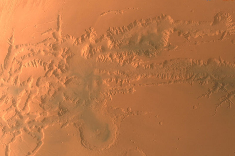
A Chinese spacecraft has acquired images of all of the planet Mars, including visuals of its south pole, which holds vast water reserves.
Tianwen-1 also sent back high-resolution imagery of the edge of the vast Maunder crater, as well as a top-down view of the 18,000-metre (59,055-foot) Ascraeus Mons, a large shield volcano first detected more than five decades ago.
Other photographs include the 4,000-kilometre Valles Marineris canyon and impact craters of highlands in the north of Mars known as Arabia Terra.
The unmanned Tianwen-1 reached Mars in February 2021 on the country’s inaugural mission there. A robotic rover has since been deployed on the surface as an orbiter surveyed the planet from space.
Among the images taken from space were China’s first photographs of the Martian south pole, where almost all of the planet’s water resources are locked.
Mars map data are expected to be accessible for public in the future. Tianwen-1 will also conduct orbit verification test for future Mars sample return mission. pic.twitter.com/VBniKT3qBu
— CNSA Watcher (@CNSAWatcher) June 29, 2022
In 2018, an orbiting probe operated by the European Space Agency had discovered water under the ice of the planet’s south pole.
Locating subsurface water is key to determining the planet’s potential for life, as well as providing a permanent resource for any human exploration there.
- Reuters, with additional editing by George Russell
READ MORE:
China Says it Will Beat US in Space Race For Mars Samples
Musk Plan for a Million on Mars by 2050 a Delusion – Gizmodo
Tianwen-1 Orbiter Captures Mars Ice Caps with ‘Selfie Stick’ – SCMP


